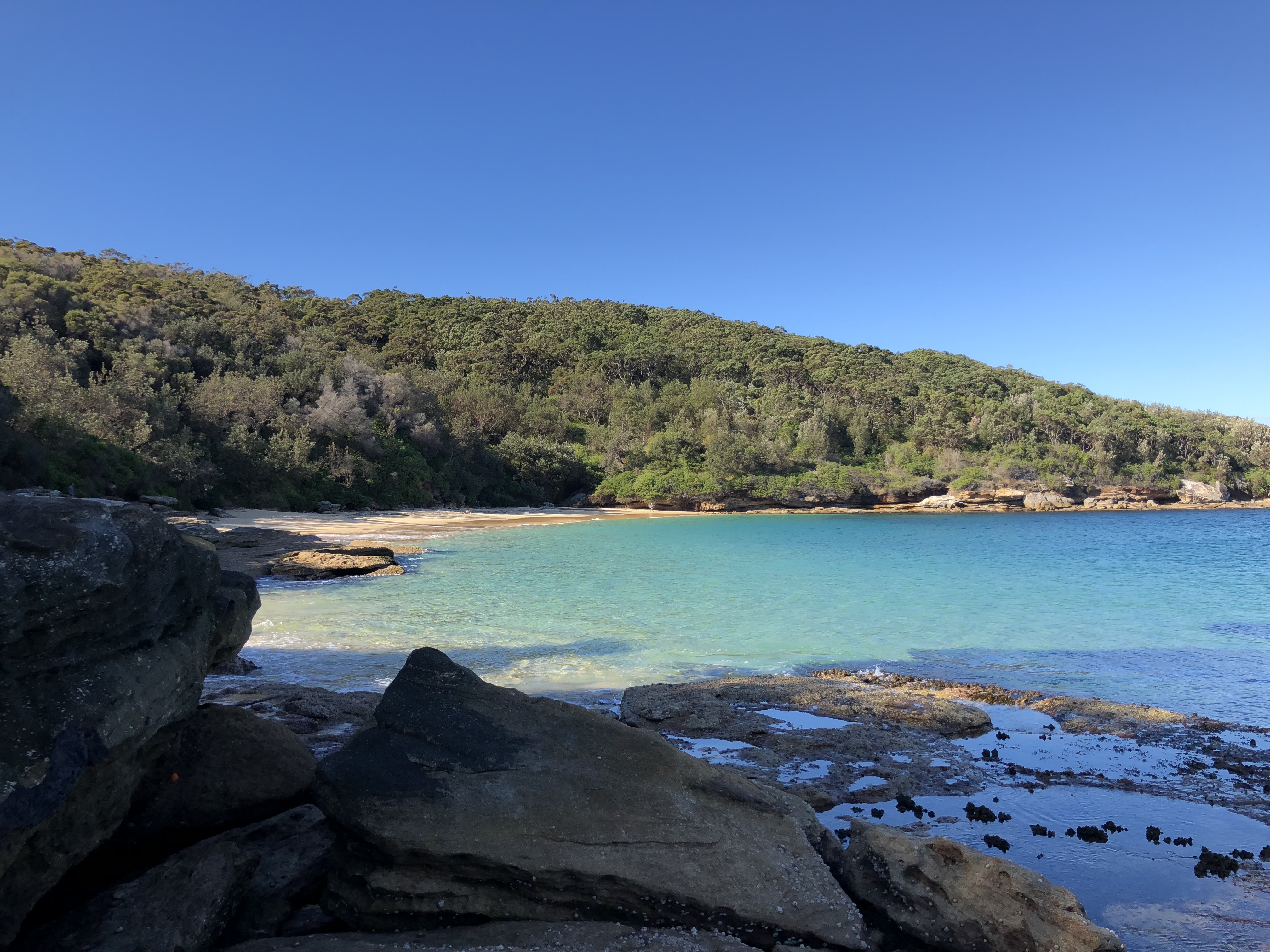
Why you must visit La Perouse, Sydney
About 20 minutes from Coogee, La Perouse is my favourite place to walk, swim and think. But it’s far more than a beautiful national park — it’s a place where Australia’s deepest and most unresolved stories are in the ether. This is my attempt to do justice to it. (18 min read)
The beautiful national park at La Perouse, about 20 minutes from Coogee, is my favourite place to walk, swim and get away from people. But La Perouse generously speaks to a much bigger story which is at the heart of Australia. Unpacking this story is not easy because it is complex, contested and much of it is not mine to tell.
I acknowledge and pay respect to the Gadigal and Bidjigal clans who traditionally occupied the Sydney coast, and the Gweagal clan of the Dharawal (Tharawal, Turuwal or Thirroul) language group who traditionally occupied the southern Sydney area which includes La Perouse. Sovereignty has never been ceded by the traditional owners and the invasion and theft of their land and sea has been opposed since 1770. Importantly, it is not my intention to speak for the traditional owners in this piece. I have used authorised information and explanations where relevant but acknowledge that this is no substitute for hearing directly from community.
Where is La Perouse?
La Perouse is a small suburb within the City of Randwick, located south of Coogee, Maroubra and Little Bay. About 1.8km2 in area, over 90% of the suburb is parkland or open space. There are only 148 dwellings in La Perouse, including 41 residential properties owned by the La Perouse Local Aboriginal Land Council. There were 366 people living in La Perouse at the last census (2021), of whom 1/3 identified as Indigenous (n=118). A further 100 Indigenous people were in the neighbouring suburb (Philip Bay) in 2021.
La Perouse is located on the northern side of Kamay (Botany Bay) and its heart is the Kamay Botany Bay National Park.
The traditional name for the La Perouse area is Gooriwal.
Aboriginal history of the area
In its Gamay Sea Country Plan, the La Perouse Local Aboriginal Land Council summarised the history of the area in this way:
Our people have occupied coastal Sydney since the beginning of time. Our ancestors moved freely within our cultural area which includes Coastal Sydney, the Illawarra and Shoalhaven regions. At the time of first contact in 1770 and 1788, it is recorded that around 1500 of our old people were living in coastal Sydney and Botany Bay.
Gamay (Botany Bay) is well known for the arrival of the Endeavor and Lieutenant James Cook in 1770, when our Country was chosen to be suitable for British colonisation. When they first arrived, the British originally called the region Stingray Bay, due to the numbers of stingrays found here, but soon after changed the name to Botanist Bay, then Botany Bay due to the wide diversity of plant species. It is now known as its traditional name, Gamay. Following the first fleet’s arrival in 1788, the British colony was established in Sydney Harbour. Our people were documented standing against this establishment. This moment is part of our history and marks the starting point of a change for our people in coastal Sydney.
Within in the first century of the colony, our people lived in traditional camps around Sydney Harbour and played an active role in the local economy with enterprise services such as tours, supply of fresh food, and artefact making and demonstrations. In 1883, as the colony grew, the NSW Government established the Aborigines Protection Board, creating laws to force Aboriginal people from traditional camps and relocate them to locations considered ‘out of sight, out of mind’.
The location for coastal Sydney Aboriginal people to remain was La Perouse (Guriwal), as it was a traditional fishing camp and would have the potential to sustainably feed the camp. The camp was established as an Aboriginal Reserve in 1884 and become the focus of a Protestant Mission in the years following.
From the 1900s, our people were under constant threat of forced relocation to other places in the growing colony.
Our community refused to move. In the 1960s our community faced more pressures, when the Mayor of Randwick wanted to again relocate the La Perouse Reserve with the assistance of the NSW Government. Our community fought to stay and, with support from local industry, we remained. Following this threat, key people in our community campaigned for better housing conditions. In 1972 and 1973 our Reserve was redeveloped and handed over to the New South Wales Aboriginal Lands Trust. Ownership was later transferred to the La Perouse Local Aboriginal Land Council after its establishment in 1984.
Today, the La Perouse Aboriginal Community maintains our connection to our cultural area of coastal Sydney, extending to the South Coast. Many of our families still reside in Aboriginal communities. The heart of our cultural landscape is Gamay and holds significant cultural importance. Our community is unique in that families living in La Perouse today can trace their ancestors back to pre-colonisation, maintaining an unbroken connection to country. We continue to represent the Traditional Owners of Coastal Sydney and Gamay.
Different perspectives on Kamay/Botany Bay
For Indigenous Australians, Kamay (Botany Bay) represents the beginning of dispossession, resistance, and the violent disruption of the Dharawal and Eora nations. A recent Guardian article gives voice to the ongoing grief and resilience of the La Perouse community.
Botany Bay (Kamay) is perceived in white Australian and British consciousness as the iconic birthplace of modern Australia’s colonial history and a historical symbol for penal exile. Many white Australians mistakenly view Botany Bay as the place where European settlement began in Australia, linking it to Captain James Cook’s 1770 landing. In fact, settlement did not commence until 1788 with the coming of the First Fleet – which spent only a week in Botany Bay before settling in Port Jackson (Sydney Harbour).
Following the defeat of a national referendum for an Indigenous voice to the Australian Parliament in October 2023, the incomplete understanding or enduring misperception of the colonial history of Kamay is deeply triggering and there are many people complicit in this misunderstanding.
The song “Botany Bay”, about a transported British convict’s lament for England, became famous in Australia due to a performance by the American folk singer Burl Ives arranged by our national public broadcaster (the Australian Broadcasting Corporation) in 1952. To prepare his performance program beyond “Waltzing Matilda”, Ives asked ABC listeners to nominate their traditional songs and he was inundated with responses. Partnering with a music professor at the University of Melbourne to compile and arrange the material, Ives ultimately made a record of 12 songs, including “Botany Bay”. While Ives was considered a saviour of Australian folk music, he also legitimised incorrect British and Irish folk memory in which “Botany Bay” is a symbol of exile, forced banishment, penal labor, and the ultimate distance from home. It is shameful that no one asked the traditional owners views about this song.
In her critically acclaimed book Botany Bay: Where Histories Meet, Maria Nugent argues the site is a contested landscape where official settler narratives have failed to erase a continuous Aboriginal presence and where history-making is favourably positioned as a meeting place for contradictory histories.
Viewing Kamay Botany Bay from the air
About half of the 800 flights into and out of Sydney each day fly over Botany Bay, including most international flights which require maximum runway distance, domestic flights from the south and a select handful of exceptional flights permitted to land outside the curfew period (11pm to 6am). There are seasonal variations with northerly winds forcing more aircraft to land over the water.
Approaching Kamay Botany Bay by water
The entrance to Kamay has changed little since the country was invaded by the British in 1788 because of the discontiguous national park. The entrance (from Cape Banks in the north to Cape Solander in the south) is about 2.4km wide and the bowl shaped bay covers about 40km2. The bay’s wider entrance makes is easier to sail into than Sydney Harbour, but the harbour is deeper and 1/3 bigger. The harbour’s fractured shoreline of bays, coves and inlets gives it a coastline of more than 240km which is more than six times greater than that of Kamay.
Mercifully, cruise ships cannot berth in Kamay and the previous Government’s plan for a dedicated cruise ship terminal at Yarra Bay was ruled out following heavy local and Indigenous community backlash.
Port Botany, Sydney’s only container shipping port, opened in 1979. It is a highly concentrated, fast-moving hub servicing about 1,600 commercial ships with over 2.5 million containers every year. About 30% of Australia’s total containerised international trade is handled through the port.
Before the container port was built, the physical area where the terminals and docks now stand did not exist as dry land. The berths, container pads, and docks were entirely underwater. To build the port, engineering teams dredged roughly 11 million cubic metres of sand from the bottom of the bay to reclaim over 260 hectares of new land out over the water.
Kamay Botany Bay National Park
Kamay Botany Bay National Park is a discontiguous dual-headland site framing the entrance to Botany Bay (known as Kamay/Gamay to the traditional owners). Gazetted as a unified national park in 1988, the 492-hectare reserve is divided into two distinct historical and geographic zones: Kurnell (the southern headland) and La Perouse (the northern headland).
Traditionally, the southern side (Kurnell) of the National Park was the country of the Gweagal clan of the Dharawal nation, while the northern headland (La Perouse) was home to the Kameygal clan of the the Eora and Dharug nation.
The shoreline of Kamay is rich with ancient evidence of first nations lifestyle, including large shell middens, stone tool scatters, and ceremonial sites. A field guide titled “Walking with Aunty Maxine Ryan” (available from La Perouse Museum) helps visitors to identify this evidence, the flora and fauna of the area and understand local history.
In 1812 Governor Macquarie banned private settlement on the northern headland of Kamay because he deemed the land unsuitable for farming. This preserved the natural habitat and confined use to defence, customs and telecommunications purposes.
Today, there are beautiful walking trails and swimming places on the La Perouse side that provide a window into what our country was like prior to colonisation. There is a short flat walking track (350m, 15 mins) off Jennifer Street which has over 100 species of native plants including the endangered Eastern Banksia and, in spring, wildflowers. The main track to the Endeavour Lighthouse on Henry’s Head (4km, 75 mins) is an easy walk with glimpses of the bay and Kurnell side of the national park. The track continues to Crewe Cove (5km, 2 hours one way) and offers spectacular views of the coast. From Cape Banks take the coastal trail to the historic hospital at Little Bay. The two main beaches are Congwong (easily accessible from an entrance on Anzac Parade near the headland) and Little Congwong about 15 minutes walk east from Congwong.
National Parks NSW has created 3 easy walking tracks on the Kurnell side ranging from 15 mins to an hour, as well as the Cape Baily Coast Walk which is medium difficulty (4km each way; 2.5 hours) starting at the end of Cape Solander Drive. Another 2km can be added to this walk by setting out from the Kurnell Visitor Centre.
Maps for walks in the Kamay Botany Bay National Park are available online.
As the State Government has been unable to secure an operator for a ferry between La Perouse and Kurnell so it is practically impossible to visit both sides of the park in one day without a car. Hopefully, this issue will be cured in the near future.
Caring for sea country
As saltwater people, Sea Country Planning is a top priority for the La Perouse Aboriginal Community:
Our management of Sea Country is subject to cultural obligations and Traditional Knowledge. Our obligations are comprised of knowledge from our ancestors, which has been handed down through generations and gives us the understanding we use daily to protect and care for our Sea Country. Our identity is based on a holistic perspective, where we know all elements of the land and sea are connected. We use this knowledge to inform all aspects of our management. Our Traditional Knowledge system is the cultural framework that guides us. We are also subject to multiple Western laws, policies and regulations.
In March 2025, the Gamay Sea Country Plan was released by the La Perouse Aboriginal Land Council. It is a superb document which explains the history, habitats and species in Kamay (Botany Bay) and the community’s key concerns about compromising habitats, ecosystems and species because of climate change, infrastructure development, dredging, tourism and pollution.
The Sea Country plan is a framework for progressing 6 identified priorities, including freedom of access to country for Indigenous people, restricting access to significant sites to community, protocols around tourist visitation, strengthening the Gamay Ranger program and caring for country initiatives.
The Local Aboriginal Land Council led the creation of an action plan as the next step, inviting partners and organisations to join in realising the vision.
Gamay Rangers
In 2019, the La Perouse Local Aboriginal Land Council established the Gamay Rangers under the Federal Government’s Indigenous Ranger Program. The Gamay Rangers undertake natural and cultural resource management activities, righting some of the wrongs that have impacted Kamay (Botany Bay). The Rangers environmental, cultural and restoration efforts ensure the habitat can sustain diverse vegetation that supports the ecosystem and its complex food web. Management is carried out in line with community needs and traditional knowledge. In addition to collaboration with the National Parks and Wildlife Service on operational activities, the Rangers partner with several universities on important projects (Seagrass Project; Crayweed Project; Seahorse Project; Marine Mammal Monitoring Project). The Caring for Sea Country Plan recommends expansion of this program.
Whale and whale dreaming
The word “Gadigal” —one of the local clan groups in Sydney— literally translates to “whale people” and whales are sacred totem animals, spiritual ancestors and cultural symbols for the traditional owners of Gamay. While there is information about the cultural significance of whales in books and online, it is important to hear about this from an Indigenous person who is authorised to share it such as in this video filmed at Kamay Botany Bay National Park.
There are 2 major artworks on the Kurnell side of the National Park that involve whales. A mother and baby whale by Theresa Ardler and Julie Squires is based on the Sydney rock engravings of the mother humpback whale and her baby out at La Perouse. According to Ardler, “this engraving is a prominent landmark from my ancestors who carved the rock and continues to hold cultural and spiritual connection to our sea and Country”.
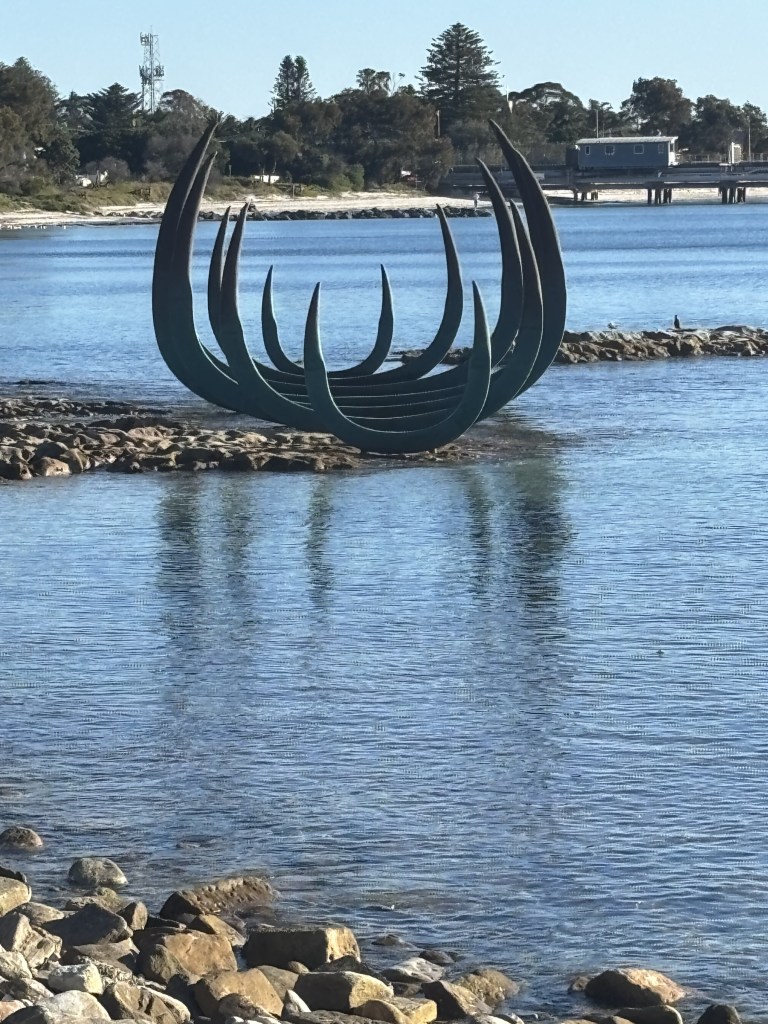
The huge sculpture called “The Eyes of the Land and the Sea” by my friend Alison Page and Nik Lachacjzak is an abstraction of the ribs of the HB Endeavour (Cook’s ship) and the ribs of a whale. According to Page, the work “is a story about discovery. Not the discovery of land by England, but of all Australians discovering our true history as we move together towards a reconciled Nation”.
While whales were not actively hunted by Aboriginal people in Sydney, if they died or ran aground people from surrounding regions would gather for massive ceremonial feasts, sharing the whale according to strict local customs.
After the British Invasion in 1788, the NSW coast quickly became a major hub for South Pacific whaling industry targeting migrating whales. As the 19th century progressed, the intense pressure of whaling drove whales away from close shore shelters like Kamay and Sydney Harbour and commercial operators shifted further south. Shamefully, whaling was not banned in Australia until 1979 with enabling legislation passed in 1980.
Today thousands of humpback and other whales travel past the entrance to Kamay Botany Bay on the “humpback highway” and occasionally some enter the bay itself. Cape Banks (on the La Perouse side) and Cape Solander (on the Kurnell side) are some of the best spots for watching the migration of whales (northwards between May and July and southwards between September and November). A viewing arena and information about the whales has been recently installed at the Cape Solander clifftop lookout.
Getting up close to the whales was one of the most beautiful experiences of my life and I can confidently recommend an ethical company departing from Darling Harbour that truly cares about these beautiful creatures.
Monuments to contact and invasion
As mentioned above, Kamay was the site of first contact with Europeans on the east coast of Australia and the intended site of the first British settlement.
On 29 April 1770, James Cook sailed the HMB Endeavour into the bay, making his first landfall on the Australian continent at the Kurnell Peninsula. As Cook’s crew rowed ashore, they were met by two Gweagal warriors who stood on the beach waving spears to defend their land. Musket fire was deployed by the British, wounding one of the men in the opening minutes of the encounter. Cook stayed 8 days in the bay and the ship’s botanists collected a staggering array of unknown flora which inspired the British name “Botany Bay” (Cook rejected the earlier names of “Botanists Bay” and “Stingray Harbour”) and upset established systems for classifying the natural world.
There is an old fashioned monument to Cook and an empty “visitor centre” on the Kurnell side of the national park (indicative of the old fashioned white nationalist sensibilities of the electorate on that side of the water) speaking at three beautiful contemporary sculptures by Indigenous artists installed on the water’s edge in 2020.
The colonial monuments on the La Perouse side are similarly dated and off-putting.
The public toilets in the Yarra Bay Bicentennial Park are marked by a monument to the landing of Captain Arthur Philip of the “first fleet”. Erected by the Municipality of Randwick in 1953 and unveiled by the Governor of NSW in 1956, the plaque states:
“In this vicinity, about 3pm on 18th January 1788, Governor Philip first set foot on Australian soil. He was seeking fresh water. On his approach, a group of natives, who had watched him land, withdrew into the bush. Later that afternoon, some of them directed him to a stream nearby (Bunkering Creek). RAHS”.
The “first fleet” was comprised 11 British ships containing about 1500 people, at least 775 of whom were prisoners (about 80% for non-violent property crimes such as stealing food, soap, livestock, clothing or passing of counterfeit coins or petty scams).
Commanded by Arthur Philip, the fleet took between 250 and 252 days to reach Australia via South America.
As Governor, Philip was responsible for the establishment of the colony of New South Wales. This was expected to be at Botany Bay (Kamay) but, after a week, Philip relocated the fleet to Port Jackson (Sydney Harbour) because of poor soil, scarcity of fresh water, swampy terrain and inadequate protection for ships against eastern winds.
On the same day that the “first fleet” sailed to Port Jackson, the French explorer Laperouse sailed into Kamay with two ships on a scientific exploratory mission. With the permission of Governor Philip, the French established a temporary camp, constructed a stockade, and planted a garden on the northern headland (now named La Perouse).
During their six-week stay, the French expedition’s chaplain and naturalist, Père Laurent Receveur, died from wounds sustained earlier in the Pacific. His grave at La Perouse stands as the first recorded European burial on Australian soil and the site is described by some as “the birthplace of Catholicism in Australia” because the first Catholic Mass was said there.
On 10 March 1788, the French ships sailed out of the bay and vanished; their wreckage was not discovered until decades later. An old fashioned monument to La Perouse, commemorating his demise, is also located on the headland.
La Perouse Museum
A bicentennial gift from France to Australia in 1988 enabled the establishment of a museum in the large historical building on the headland at La Perouse. This building was initially a global telegraph hub (1882-1917) and later a Salvation Army Home for women and children escaping domestic violence (1944-1987). In the interim period the building became a home for Little Bay’s Coast Hospital nursing staff. It was also used to house military personnel and soldiers during wartime.
For the first 21 years of the museum’s operation, it told the story of La Perouse and the 6 weeks he spent at Kamay Botany Bay. In 2009, the museum refocused to stories about the people of La Perouse. This was not uncontentious given its role in cultural diplomacy and importance to the French community.
In 2017, responsibility for the La Perouse Museum was transferred from NSW Parks and Wildlife Services to the Randwick Council under a 42 year lease. Despite some aspects of the museum being refreshed in January 2026, a lot of work is needed to lift it to the standard of this museum. Despite its limitations, the museum is an important way to get a deeper understanding of the area. There are exhibitions about the history of the suburb and the building (including the Cable Station story), the application of Indigenous craft to souvenir making and the renowned snake man, as well as La Perouse himself. I recently saw an interesting temporary exhibition on the habit of the area and the work of two Indigenous photographers.
The Randwick Council’s vision for a new First Nations Cultural Precinct was announced in May 2025, along with an artist’s impression of the site but funding to realise this vision and the detailed operating model is unclear. The Council is currently consulting the public on the 5 year strategic plan for the Museum and, given the importance of this issue and my background in museums, I wrote to them with my views.
Some other places of interest at La Perouse
In addition to the Kamay Botany Bay National Park, Dharawal Resting Place and the La Perouse Museum, there are several interesting things to see and do in the La Perouse area. Because interpretation and signage is patchy and the landscape has changed over time, it is best to arrange a tour with a local guide such as Aunty Maxine Ryan or at least follow her guidebook (available from the La Perouse Museum) or do one of the cultural tours occasionally organised by Randwick Council.
For the truly independent, I have created the following trail but if you’d like to discuss it over breakfast before you head out, that’s something I can arrange.
A self-guided walking trail for La Perouse
After visiting the museum, I suggest you start with monuments next to the museum beginning with the Tomb of Pere Receveur and then the Monument to La Perouse.
Macquarie Watchtower, which is behind the La Perouse Museum, was built in 1822 to keep watch for smugglers and then served as a customs station. It was also used as a school from 1868 to 1910 after additional buildings were added. Following a fire in 1957, a castilated parapet was added and the windows enclosed. It is not currently accessible to the public.
Bare Island, located just off the La Perouse headland, which is closed to visitors until August 2027. The island, which was named by Cook, has been a national defence site and veteran’s home. It is also popular place for snorkelling and for watching the sunset.
Start your walk north at Endeavour Avenue on the roundabout, noting that it was called Aborigines Avenue until the 1950s. Despite the name change, Aboriginal people have defeated the racist assimilationist policies of those times.
Gooriwal Cultural Landscape, inscribed on the State Heritage Register in 2024, stretches from Frenchman’s Bay to Yarra Bay. Walk on the paved path from the headland to Yarra Bay Bicentennial Park noting it snakes past places you cannot visit like the La Perouse Aboriginal Reserve which includes the Protestant Mission Church, Happy Valley and Frog Hollow and Yarra Bay House. This walk includes many interesting indigenous plants and birds.
Check out the monument to Arthur Philip in front of the toilets at the Yarra Bay Bicentennial Park on your way to the Botany Cemetery which contains the graves of several interesting characters. I suggest walking back along the beaches noting the site of the former Yarra Bay Pleasure Grounds and how hard it is to find shells on the beach.
If you would rather skip the beach, you can walk to Indigrow (an Indigenous owned and operated plant nursery adjacent to La Perouse School) and return to the headland via Anzac Parade.
Or if you have more time, on the top of La Perouse National Park is the prestigious NSW Golf Club which opened in 1928. Offering an 18 hole course with ocean views, this private club only permits unaccompanied guest play by visitors who reside outside of New South Wales. Reservations are required and various rules apply.
The Golf Club, which is divided by Cape Banks Road, is adjacent to the Dharawal Resting Place. After visiting this sacred place, walk back to the headland through the national park.
Optimism for the future
It is such an exciting time for La Perouse.
The recognition of the Gooriwal Cultural Landscape, the superb plan for caring for Sea Country, the promise of a First Nations Cultural Precinct and enhancements to the Dharawal Resting Place, along with extraordinary businesses like Indigrow and the Gamay Rangers program, point to an ever better future.
With so many troubles in the world, the empowered wisdom of First Nations people – with cultural responsibilities to care for country – is a foil to vested interests and a way to restore balance. It is worth learning about this unique, exceptional place.
Namaste.
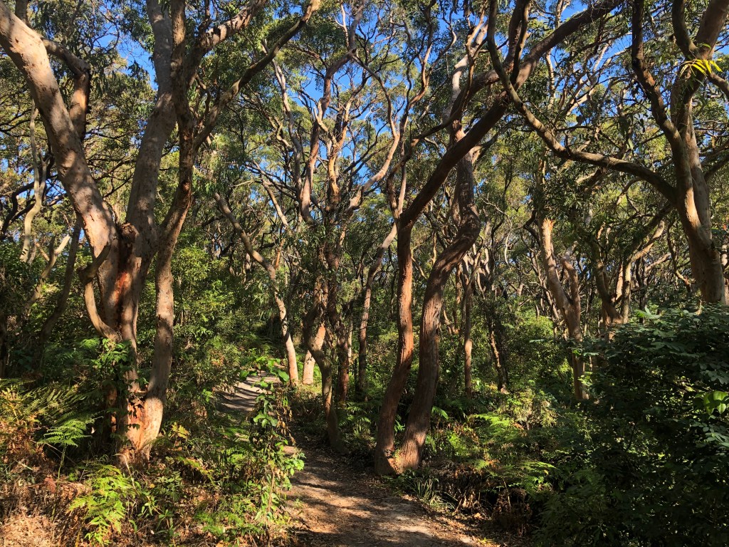
(La Perouse)
You might also like:
→ The future of La Perouse Museum?
→ Dharawal Resting Place: Bringing Aboriginal ancestors home to Country
→ Coogee’s origin story and the naming of Yanggaa Forest
© Paul McCarthy & Iluminar.au

